Summary stats

Total days: 365
Flying days: 84

Total flight hours: 228.1
Cross-country hours: 197.6
Landings: 152
Airports: 108

States, provinces, and territories: 31 — Alaska, Yukon, British Columbia, Alberta, Saskatchewan, North Dakota, Minnesota, Wisconsin, Michigan, South Dakota, Montana, Idaho, Nevada*, California, Arizona, New Mexico, Texas, Arkansas*, Alabama, Georgia, Florida, South Carolina, Virginia, West Virginia, Pennsylvania, New York, Kentucky, Indiana*, Illinois, Nebraska, Wyoming — (27 states, 3 provinces, and 1 territory)

* Stopped only for fuel and didn’t leave the airport; would not pass the “step on soil” criterion used in my family to define having “been to” a place.

Miles traveled: about 17,000 (or nearly 15,000 nautical miles).  This is point-to-point from the google map, and so not taking “meandering” into account.  Also, whether to include “day trips”, and how, makes this calculation tricky.
Fuel burned: about 1330 gallons

Longest flight (in miles): Middleton WI -> Crete NE: 364 NM
Longest flight (in time): Rapid City SD -> Bozeman MT: 4.0 hours (360 NM but fighting headwind)
Shortest flight (in miles): New Richmond WI -> Oscola WI: 12 NM
Shortest flight (in time): One trip around the pattern at Morgantown (Michelle’s “confidence flight”): 0.3 hours.  Possibly the smallest entry in my entire logbook.

Longest flying day: 7.4 hours (Sightseeing flight out of Eveleth, MN in the morning, and then Eveleth to Aberdeen to Rapid City, SD)

Longest runway: Roswell, NM (13,001 ft)
Shortest runway: Chicken Strip, CA (1300-ish ft)

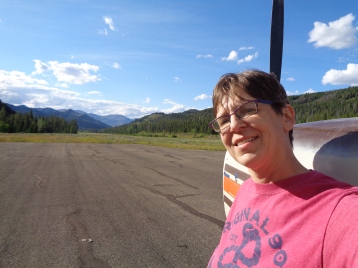
Most time spent in one place: Morgantown WV, obviously, with 101 days (thanks, COVID, but no thanks)

Cost: I haven’t gone through all my receipts and added up all the purchases of fuel, parking and camping fees, quarts of oil, maintenance and repairs, and all that… but I did try to draw everything from one designated bank account, and it looks like I spent about $13,000.
Most expensive airport (per night): Key West, which charged $25/night plus various handling fees, some of which could be waived with the purchase of very expensive fuel, but not all.

Hmm… what else?

Funniest billboard: a pair of them seen in the Dallas area: on the left: “DIVORCE?” and on the right: “GUN SHOW!”

People to thank: a list that would be very long, and seeming inadequate no matter how hard I tried to include everyone, but especially all the people who offered me hospitality for a night or a week or three, including:  Lynn, Albrecht, Matthias and Larissa, Ed and Diz and Brad, Jim, Rellen, Jenny, Emily, Paul and Stacey, Doug and Chris, Eric and Ellen, Louise and Dan, Betsy and Greg, Jodi and Peter, Brennan, Melanie and Tillman, Chris, Ron, Leslie, Jodi and Steve, Dawn, Ann and Kat, John and Leslie, Mary and Jack, Terry and Patricia, Segev and Maggie, Stefan, Tom and Lynnette, Brian and Rachel, Daren and Jill, all the friendly airport folks whose names I don’t know who helped me along the way, and the most massive of thank-yous to D.J. who put up with me way beyond the original plan as a crisis unfurled (and all the Morgantown “bubble” who took me in: Michelle, Alex, Jen, and Original-Alex), and Paul who had to suffer my absence for all of this to be possible.

 

Posted in Uncategorized | Leave a comment

Catching up on stories: coming home

All the electronic and telephonic preparations for the next border-crossing, all while eyeing the weather in Whitehorse and through the mountains heading northwest. But the weather was looking great, much better than yesterday, and the briefer on the phone described it as “good VFR” with the kind of cheery tone of voice that suggested nothing could possibly go wrong. Indeed: high ceilings and easy navigation following the highway.

DSC01571

The place where you cross the border into Alaska is an airport called Northway, which is pretty much in the middle of nowhere. They have to send a customs agent from the road border station 45 minutes away to meet you there, which is why it’s important to call ahead and be on time. I landed shortly after another plane, so I think the agent was grateful to be able to handle two aircraft with one trip.

“So, who is Paul?” asked the agent when I opened the door and said hi. This is not a customary question at a border crossing… but apparently there had been some behind-the-scenes activity while I was in flight. Whitehorse was tearing up the pavement in front of the fuel pumps that morning, so avgas was unavailable. This was something I’d known about (because I read NOTAM’s!) and so I had fueled up when I’d first arrived two days before. But apparently another female pilot planning to head to Northway that day had had to cancel due to lack of fuel. The customs guy thought the cancellation was me, but just to be sure, had called the phone number associated with the registration of the airplane, and reached Paul, who was able to say “No, no, Kath got her fuel the other day, and in fact, she’s already airborne…” Without Paul and the resourcefulness of the customs guy, I might have arrived to an empty airport.

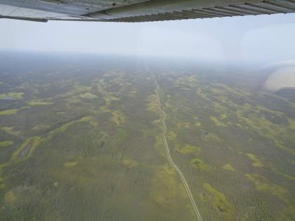
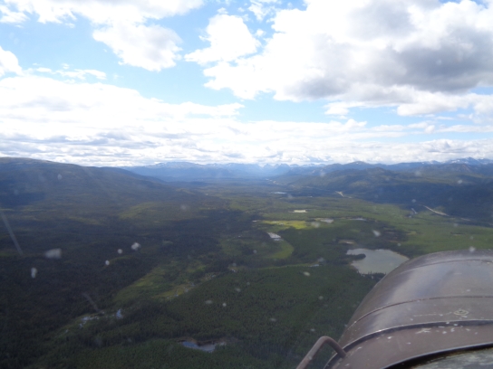
The weather in Alaska was clear and cloudless, but covered in haze. At 3000 feet, I wondered whether it was low-level stuff I could climb above. At 6500 feet, I could see what looked like tantalizing blue sky above. At 8500 feet, the view above looked exactly the same — equally tantalizing above — so I figured it was just hazy everywhere and gave up on climbing higher. So I didn’t take as many pictures as I might normally. Just highlights, like this bit of the Alaska Pipeline:

DSC01575

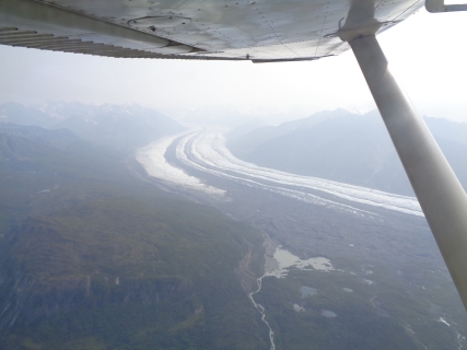
The Matanuska Glacier:

DSC01579

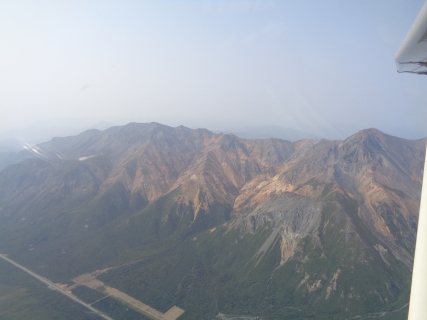
The mountains next to Sheep Mountain Airport:

DSC01576

Embarrassingly, I had to look up all of the comm frequencies for what had once been my home aerodrome. And I had forgotten how crazy busy Merrill Field is. But once passing Palmer, everything felt familiar. “Straight-in Runway 25, report Muldoon,” said the Tower controller, a phrase I’ve heard a gazillion times. And I still remember my way around the maze of taxiways and gates.

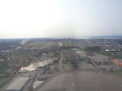
Final approach to Merrill Field:

DSC01583

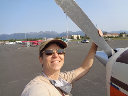
…and a hero selfie after arrival:

DSC01591

We had given up Becky’s parking spot when I left, but Paul had secured a new one for my return, and had parked the car in the spot. Both so I could find the new spot, and also so I could drive home. So now I’m home!

I’m not entirely sure how to feel about all of this. It’s nice sleeping in my own bed again, and to have a kitchen. But I haven’t unpacked my suitcases, as if I’ve arrived at a really big hotel that I can hang out in for a while. Without Paul, it doesn’t really feel like coming home quite yet. Plus, I will be quarantining for 14 days, so I can’t meet up with friends or go out to dinner or do anything celebratory.  (Not even buy my own groceries)  Instead, I’ve spent the day pulling weeds from the planter boxes in the yard and proofing the sourdough starter.

Tomorrow I’ll unpack my teaching computer and start figuring out the Fall semester.  Also, compile final stats for the voyage.

Posted in Uncategorized | Leave a comment

Arrived: Merrill / Anchorage (home!!)

Just a quick note to let y’all know that I made it home today!  A long day, following first the Alaska Highway to Northway (customs) and then Tok (fuel), and then following the Glenn Highway through a few more mountain passes to Anchorage.  Very hazy weather, so much so that photography along the route felt somewhat pointless.  I took a few photos anyway.

Paul is not here; as you may remember, he was on his way driving south when we met up in Cut Bank, Montana.  So the house is empty, more or less just as I left it.  So the trip ends just as it began: alone.*

*…or nearly.  When Paul learned that I was airborne and enroute, he gave our local pilot friend Paul D. a call, and he met me at the airport just to welcome me home and make sure everything was OK.

Tomorrow, after downing a Mike’s Hard Lemonade or two tonight and sleeping for a billion hours, I will download the last of my photos and write a longer blog post about the last flights home.  It’ll be a good way to begin what will be my 14 days of quarantine as a new arrival to Alaska.

Posted in Uncategorized | 2 Comments

Arrived: Whitehorse, YT (in the rain)

Still trying to blast through Canada as fast as I can, but combating (as always) the forces of weather and fatigue.  I shared the Fort Nelson lobby-camping with another American transient heading north.  He had flown 15 hours in one day, all the way from Idaho.  That’s crazy!  He left before I did in the morning, headed the same route as me through the mountains of the Yukon.  The nature of the route, snaking through mountain canyons following the Alaska Highway, gives the weather a heightened importance; you can only continue forward, or turn back.  On this day, there were clouds, but reliably at 6000-6500 feet with good visibility beneath, with occasional rain showers around to either dodge or fly through.   

DSC01567

In the last 60 miles approaching Whitehorse, the rain and mist increased and the visibility dropped, although it was still good enough to see.  Occasional glances backwards to make sure I had an “out” if it got worse.  Light rain splattering the windshield, but the clouds still high enough to fly under.  Whitehorse has a long runway for big airline jets, and with the rain and mist they had turned on all the runway and approach lights: the lights embedded in the runway itself and the line of lights extending in front of the runway that blink in a rhythmic “follow me home” pattern (called the “rabbit”).  I love this view and these lights; it’s a view only pilots get to see.

I was leapfrogging with my hangar buddy all day — saw him again in Watson Lake, and he arrived at Whitehorse shortly after I did.  I decided to spend the night in Whitehorse, but he waited for a pause in the rain and then continued on, to one of the gravel strips further up the road.  Oh, to be young and to have that kind of stamina…

Today the weather has gotten worse, and I’m staying put here until it lifts, which should be tomorrow according to the forecasts.  Then I run for the border.

Posted in Uncategorized | Leave a comment

Arrived: Fort Nelson, BC (and unstuck)

The mechanic, named John, arrived early in the morning to take a look at my master switch.  A very thorough guy, this one, who started at the battery box and ohm-metered his way systematically through the airplane’s wiring… until he discovered that the master switch’s ground was not making a good connection.  That ground wire goes up into a rat’s nest of other grounds in some sort of box, and the entire thing was loose in its bolting to the actual airframe.  (I haven’t actually seen this for myself — this is John’s description as he lay on his back in the place where the pilot’s seat would normally be, with his head next to the rudder pedals looking up behind the panel.)  He was able to tighten the whole box back up, and everything came alive again.  Furthermore, this fix prevented who-knows what kinds of other electrical grounding issues that were about to strike.

As John worked, the Canadian Government called.  They wanted to check on my progress through the country, and to make sure I was still wearing a mask and not interacting with people, and that I had enough food, and when can I expect to be through the country.  I can probably expect another one of these calls in a few days.

As John was finishing up, I saw a fuel truck pull up to service another airplane.  I ran over.  “Do you sell avgas, and can I buy some?”  The guy said sure.  Lucky break on a Sunday!  Perhaps the gods are smiling on me today for some reason.

Time, finally, to launch.  A beautiful sunny day, barely a cloud in the sky.  A couple hours to Dawson Creek, where I had read there was a restaurant in the terminal building.  I ordered a burger — haven’t had anything but from my camping supplies for a few days!  I met another American pilot in a Super Cub who was also headed north.  He took off before I did.

The route to Fort Nelson took me over some forbidding country, still east of the Rockies.  Something about the wind pattern was setting up powerful “mountain waves” — this is where there are alternating updrafts and downdrafts from the air spilling over the tops of the mountains.  In the updrafts, you can throttle back but still climb; in the downdrafts, you can apply full throttle and pitch for climb and barely hold altitude.  A wild ride.

About 5 minutes after I landed at Fort Nelson, the Super Cub guy landed too.  Hi, again!  He was going to push on to Watson Lake tonight, and called out the fuel guys to fuel him up.  Not me… I’m too tired, and am going to stay the night here.  The fuel guy said he would leave the hangar door unlocked for me so I could sleep in there (like I did on the way down: “hillbilly camping”).  “You don’t want to be outside,” he said, “the bugs are vicious.”

From here on, I will follow the Alaska Highway.  The route is fixed, the airports pre-chosen.  Which means watching the weather closely and picking the right time.  But first, sleep.


Posted in Uncategorized | Leave a comment

Arrived: Whitecourt, AB (and stuck)

Whitecourt was intended as a fuel stop, on the way to Dawson Creek.  Two problems with this plan, as it turns out.  One: the fuel service here is only Monday-Friday, and the flight service briefer didn’t catch this, and neither did I.  Two: the airplane’s master switch seems to have died.

The “master switch” is a big red toggle-switch next to your left knee.  Turning it on is supposed to bring all kinds of electrical things to life: the gyroscopes, the flaps, the fuel gauges, the starter.  You turn it on right before starting the engine.  So after I’d computed that I had enough fuel to make it to Grande Prairie with some reserve, I climbed in, flipped the switch… nothing.  No whirring of gyroscopes, no instruments lighting up, and no starter.  Eerie silence.

It took some wandering around to find any humans at Whitecourt on a weekend.  The first, a helicopter mechanic, took a quick look and guessed that it was a bad switch but wasn’t sure.  The second said that he knew a great airplane mechanic, who had just driven away 5 minutes earlier… we got ahold of him on the phone, and he’s going to stop by tomorrow morning to have a look.

So I’m here tonight.  I’ve manhandled the plane into a grass parking spot and tied her down in the fierce wind.  The tent is pitched under the wing.  I’ve eaten a meal.  It’s a kind of industrial airport, with mostly helicopter services and training — someone has been doing helicopter touch-and-goes a lot of the afternoon.  But there’s a little flight service terminal building open with chairs and restrooms and wifi.  I may or may not be able to get fixed up tomorrow, but hopefully I’ll at least learn how long I’ll be stuck here.  Paul has already started researching parts distributors in Edmonton just in case.  (I hope it turns out to be something dumb!)  Meanwhile, the wind has started to die down, and the helicopter mechanic has stopped by to check in and make sure I’m OK for the night.  Even when faced with something stressful, there’s a kind of calm that settles over you when you know you’ve done everything you can for the day.

Posted in Uncategorized | 1 Comment

Arrived: Olds-Didsbury, AB

Canada again!

The US-Canada border has been “closed to non-essential travel” since the pandemic broke in March.  But transiting the country to get home to Alaska *is* considered essential.  When I asked the Cut Bank airport guy about the best place for a northbound border crossing, he recommended a grass strip called either Del Bonita or Whetstone International Airport (depending on whether you’re talking about the Canadian or U.S. name for the same place).  The runway runs east-west, right along the border.  On the west end of the runway is a road crossing with both U.S. and Canadian customs gates.  A pilot from either country can land here, and can clear customs here in either direction.

Paul dropped me off at Cut Bank Airport, helped me fuel up, and I got a bit emotional.  He’ll be heading south, and I won’t see him until late September…

The Del Bonita airport’s grass is in need of mowing, although the underlying surface is okay; the propeller cuts its way through some wildflowers as you navigate the strip.  The customs agent had a few additional questions for me, beyond the usual “any alcohol, tobacco, or firearms?”  He asked if I was planning on meeting up with anyone, and how many miles I was planning to cover each day.  Because of COVID-19, through-travelers like myself are supposed to stick to *just* traveling; no recreation, no socializing, no going into town.  “We pretty much just want you to stay with your airplane,” said the agent.  He asked me if I had enough food, eyeing my cargo compartment with its boxes of Goldfish crackers and ramen noodles.  When he asked if I had a planned route, and I said yes, he wanted to know what it was.  (For those of you following along at home, the plan is: Del Bonita -> Olds-Didsbury -> Whitecourt -> Dawson Creek -> Fort Nelson -> Watson Lake -> Whitehorse -> Northway.)  He was writing down all of these names.  I wouldn’t be surprised if someone at Border Services checks up on my progress from time to time to make sure I’m not doing any recreating.

So onward, to an airport a bit north of Calgary, in between the town of Olds and the town of Didsbury.  The weather was stunning for most of the trip, but low clouds covered the city of Calgary and much of its surrounds.  To avoid them, I had to fly so low that the Calgary Approach controller gave up on me and released me from control under the outer shelves of the airspace.  The low cloud cover was intermittent, and I was worried that it might cover my airport… relieved when the runway came into view.

This being Canada, I was not on the ground for 10 minutes before friendly people approached one after another to see if I needed anything.  “Staying the night?” asked the first guy.  Yup… Can I pitch a tent here?  He chuckled, and said “Sure, this is Canada!  It’s supposed to rain tonight, though, so if you want you can sleep on the couch inside, in the pilot’s lounge.”  He then tried to help me find tiedowns (because there were thunderstorms forecast to roll through later) but to no avail.  “I’ve got a hangar in Red Deer, you could come there.  Got a washroom and everything!”  That’s another airport a little ways up the road; I didn’t want to fight the low clouds anymore today, so I declined.

20 minutes later, a second guy *did* know where there were tiedowns, and gave me a ride in the back of his truck to see where they were.  They face west; “The weather always comes out of the west.  Say, do you need anything from town?  You got enough food?”  Yup, Paul and I stocked up at the grocery store yesterday.  As I returned to the plane to taxi to the tiedowns, a third guy drove up.  “Do you know about the tiedowns?  ‘Cause there are thunderstorms supposed to roll through later…”

Once Becky was tied down, I took a long nap on the couch.  I always find border crossings stressful, even when they needn’t be.


Posted in Uncategorized | Leave a comment

Out-of-order post from Benchmark, MT

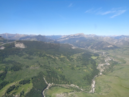
Montana is full of backcountry airstrips in the mountains, each a different variety of challenging. Even the large commercial towered Helena airport has lots of Super Cubs and 180’s and other bush-wheeled high-wings picking up fuel on their way to or from the backcountry. Asking around for good places to fly, some Helena locals recommended Benchmark, a mere 60 miles or so northwest of Helena, at 5400 feet elevation. A good “junior varsity” mountain airport.

DSC01522

Landing itself at Benchmark is not the challenge; the runway is paved and a generous 6000 feet long, even at this altitude well within the skills of a competent private pilot to make a landing. The challenge is finding it, and having the courage to descend into a valley with imposing 8000-foot peaks on either side. One must be 100% certain of the navigation for this kind of thing. Don’t descend into a valley unless you know that there’s either an airport or a way out (or ideally both) at the other end. Becky’s GPS came in very handy for this, mapping the terrain in fine detail, and the chart depicting with the thinnest line available to the chartists the tiny dirt road that winds up the valley to the airport. (Roads that lead into the mountains come out the other side most of the time. Most of the time!) The last few miles felt like flying an X-wing down a trench in the Death Star, the only option being forward, the enticing runway becoming visible in the middle of the canyon. The “terrain warning” feature of the GPS, however, was not pleased with my flight at all, and began exploding with yellow and red terrain warnings and plaintive pleas to “PULL UP! PULL UP!” Time for the “INHIBIT TERRAIN” button again. No time for pictures, must focus! I had read that Runway 30 is the only one you should use for takeoffs, because there’s room to climb out without hitting a mountainside, so I approached from the south, so that I could eyeball the wind down Runway 30 and land if it was favorable, and strafe the runway and come around again if it was not.

Ten minutes after my landing, another plane (a homebuilt RV-10) came in and landed as well. The couple from Wyoming had come just to check the place out, wander around, and take off again. They had trouble starting their engine, and eventually gave up and got back out. I offered assistance, but they said No, these things are just hard to start when they’re warm. We’ll just let it cool off thoroughly and try again. Attempt #2 was successful.

DSC01536

The place is just beautiful, tall green mountains in the sunlight on all sides. There is a well-equipped little campground here, complete with firepits and picnic benches and an outhouse shack — the kind split in half for “men” and “women”, although why such a distinction should matter in the slightest in this kind of place baffles me. The land surrounding the airport belongs to the Forest Service, and so everything is surrounded by rudimentary fencing, whether to keep out humans in or animals out I can’t say. There’s the babble of a brook from just beyond the fencing, and wildflowers of myriad colors (yellow, white, blue, pale-purple) are everywhere. It’s really gorgeous, and now that the RV-10 couple have left, I am completely alone but for the occasional rumble of an ATV or a truck towing a camper trailer on the nearby dirt road. The dominant form of fauna here is flies. Both small ones that don’t bite, to enormous ones that you can see plunge their proboscis right through the fabric of your shirt.

DSC01533

I’ve started reading a novel called “The Dog Stars,” which was bequeathed to me by Daren when I passed through Nebraska. It’s about a pilot in a post-apocalyptic future in which most of humanity has been wiped out by a flu-like pandemic. The story is grim, the protagonist a man consumed by loneliness, whose only company is his loathsome survivalist partner, his dog, and the Cessna 182 that he uses for patrolling the territory that they’ve carved out for survival in the Colorado mountains. The author is clearly a pilot himself, so I’m enjoying all the aviation content, but there’s a lot of introspection about searching for beauty and self in a world that has lost its soul. Given that I’ll be spending the night in solitude in this mountain oasis (as a pandemic rages in the world beyond), I wonder whether cracking this particular novel in this particular place was a good idea. On the other hand, there is zero cell service here, really zero zero zero. Introspection it is, then.

DSC01537

DSC01544

Posted in Uncategorized | Leave a comment

Arrived: Cut Bank, MT (again)

I spent yesterday at a mountain airport in Montana called “Benchmark”.  It’s a place with no cell phone service at all, so I wrote up a long blog post and took tons of pictures, but was unable to upload any of it…  I’ll have to back-post that one soon, maybe tomorrow…

This morning, I packed up the campsite at Benchmark and have come to Cut Bank.  It’s the northernmost airport around here (still on the U.S. side of the border) that has fuel, and will make a good jumping-off point for the next border crossing.  I came through here back in 2012, heading south and using it as an Airport of Entry into the states.  I remember meeting friendly people here who gave me great local advice, and sure enough, I am finding the same thing again.  In fact, I wonder if the friendly bearded guy at the FBO might be the same guy.  They’ve recommended the best border airport for a northbound border crossing, and gave me the debrief on the landing and parking procedure for clearing Canadian customs.  They are also offering me the FBO’s transient-pilot facilities: a kitchen, a shower, and a little room with a bed.  Wonderful!

Meanwhile, as I write this, my dear husband Paul Andrew is somewhere in Alberta, on the road southbound.  He’s got a film gig in Los Angeles for a few weeks, and is driving the production van there.  So we will literally cross paths!  The plan was to meet up “somewhere in Montana” before I make my crossing, and it looks like Cut Bank will be the place.

Time to catch up on emails…

Posted in Uncategorized | Leave a comment

Arrived: Helena, MT (again)

A long takeoff roll and anemic climb rate out of Rawlins, as can be expected in the 8500-foot density altitude.  But a beautiful day for flying — with (as seems usual) clear skies and (as seems not usual) calm winds.  Wyoming has vast swaths of hilly and rocky terrain, with few options for emergency landings in between.

DSC01503  DSC01512

I chose 10,500 feet to cruise, but even there had to sidle up to the eastern edge of the Rockies as I crossed into Montana, where things got greener.

DSC01517

As I’ve mentioned before, I’m trying to avoid landing at the same place twice, but I will make exceptions for certain especially awesome places, and one such place is the Helena Airport.  The reason is the pilot’s crash-pad bunkhouse called “Mustang Mickey’s”, which sits right at the base of the control tower next to the self-serve fuel.  I had heard about it and visited here back in 2012, and you can read more about it in the “Arrived: Helena, MT” blog post from 8 years ago.  I even found my name from that visit in the guestbook!

The plan is to decompress for a couple days, and take care of a few things that can only be done with access to a town and a courtesy car, like a haircut and laundry.  I seem to be drinking a lot of water; I may have been dehydrated.

My favorite part about places like this is being able to witness the airport’s transition from day to night, with the runway and taxiway lights coming on, the flying airplanes dressed in their red and green and white lights, the parked ones silhouetted against the sunset.  A sense of calm, beauty, and order.

DSC01520

Posted in Uncategorized | 1 Comment